Outdoor environment · Map the big pictureDeepSeeGo

Earth observation explorer for Indian cities

Settlement growth, water, land cover, buildings, climate, air and terrain from open satellite and reanalysis data, for any region of India. DeepSeeGo shows every map free; DeepSeeGo Pro adds nine analyses, PDF and CSV reports, and a companion who explains every method and its limits.

Live tool
ResearchConsultancyDissemination
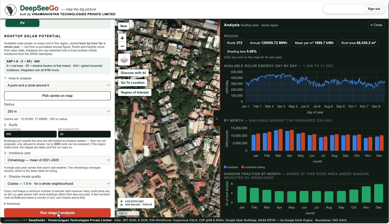
DeepSeeGo: rooftop solar potential solved hour by hour for a Bengaluru neighbourhood
Products

What DeepSeeGo offers

Inside DeepSeeGo Pro

Nine analyses, one plan

Each runs on the region you draw or pick and ends in a map, a chart, a PDF and a CSV.

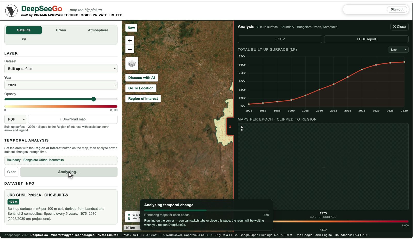
Temporal analysisHow a map layer changed over the years in your region, 1975 to 2030.Built-up surface, volume, land cover, water
Rooftop solar potentialAnnual solar energy on every roof, solved hour by hour with shading from neighbours.ASP = A · (1 − SF) · GHI over 8,760 hours
Health vulnerabilityHeat, air, flood, people and access, ranked by ward or cell.For city health and disaster teams
Site briefLand cover, climate, air and buildings for one site, in a page.For architects and developers
Zonal analysisZones around lines or points, then statistics per zone.Metro corridors, highways, wards
15-minute walkabilityScore points for the amenities within a walk.OpenStreetMap amenities
Sun & shadowSun path and building shadows at a site, any hour of the year.2.5D buildings
Slope analysisElevation, slope and terrain profile between two points.NASA SRTM
Air dispersionPollutant plume from a source, AERMOD formulation.In development
Research, consultancy, dissemination

Research behind it. Consultancy built on it. Teaching from it.

The same three pillars hold up every Vinamravigyan brand. This is how they show up in DeepSeeGo.

Research

What we have published and are building

  • Built-up volume across city zones, 1975 to 2030, for Bengaluru, Chennai, Kochi, Kolkata and Mumbai
  • Roof-by-roof solar potential with ray-marched hourly shadows and ERA5 irradiance
  • Air-pollution dispersion across city zones (in development)

Consultancy

What you can hire us for

  • Ward-level solar potential maps for city governments, starting with Mangaluru
  • Rooftop solar and net-zero feasibility for campuses and housing
  • Built-up density, heat and flood vulnerability studies for planning and site selection

Dissemination

What we teach and share

  • Open zonal reports on how Indian cities are growing
  • Workshops for planners and architecture students on reading satellite data
  • Vinamra, the mascot, explains every method and its assumptions inside the app
Built on
JRC GHSLGoogle Open BuildingsESA WorldCoverERA5-LandCAMSNASA SRTMOpenStreetMap
The DeepSee family

One method, four scales

From the sky above a city to the air in your lungs. Pick the brand that matches your question; your sign-in works across the DeepSee apps.

DeepSeeGoOutdoor environment · Earth observation explorer for Indian citiesDeepSeeInIndoor environment · See deep inside the air, heat, light and soundDeepSeeMeYou, the occupant · The heat your body carries, the air you actually breathe, the night you sleep throughDeepSeeBitThe building itself · Façades that recover heat, panels that get a second life, and an AI architect-engineer who reads the rulesVinamravigyanThe company behind the four brands: research, consultancy, dissemination.